- Once logged onto the Premier Crop website, click the “Mgmt Zones” tab.

- Scroll down and select the “Upload an overlay layer to add to the map” button.

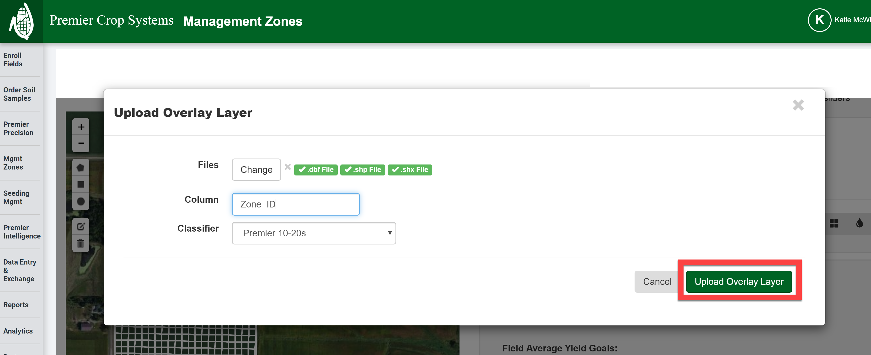
- On the Upload Overlay Layer prompt appears, select the “Select files” button.
- Once the Open window appears, select the .shp, .shx, and .dbf files and click the “Open” button.
-
Note: If you get an error that the shapefile you are trying to upload exceeds the size of the shapefile that PCS’ website will allow, try merging the prescription’s values in SMS before exporting it. See the Premier Process: “Merging Polygons in SMS” for further instructions.

-
- After the .shp, .shx, .dbf files have been selected, then enter in the EXACT column heading that you are wanting use from this shapefile and click the “Upload Overlay Layer” button.
- If you have any questions or issues, contact your advisor support representative for assistance!